Reference PhotosBefore reference photos
1999:
USGS Satellite Image of the Cooper River and Bridges

October 13, 2003:
Terraserver.com has graciously contributed
this 2 meter resolution satellite image of the bridge construction site -
(click for the high resolution image). You can clearly see the east and west on ramp
work as well as the east and west pylon construction.

and compare with the October 12, 2003 photo of the east and west
pylon taken at the SC Aquarium


After Completion
May 22, 2005 From the top of the west pylon
Where the Ashley and Cooper Rivers converge to make the Atlantic Ocean

From the top of the west pylon - Charleston

From the top of the west pylon - Looking west

From the top of the west pylon - Mt. Pleasant

A panoramic view looking west

A panoramic view looking east

Here are the component photos to build
the panorama
Every bridge must have a secret - and our new Cooper River Bridge is no
exception. Can you find the secret stone in this photo?

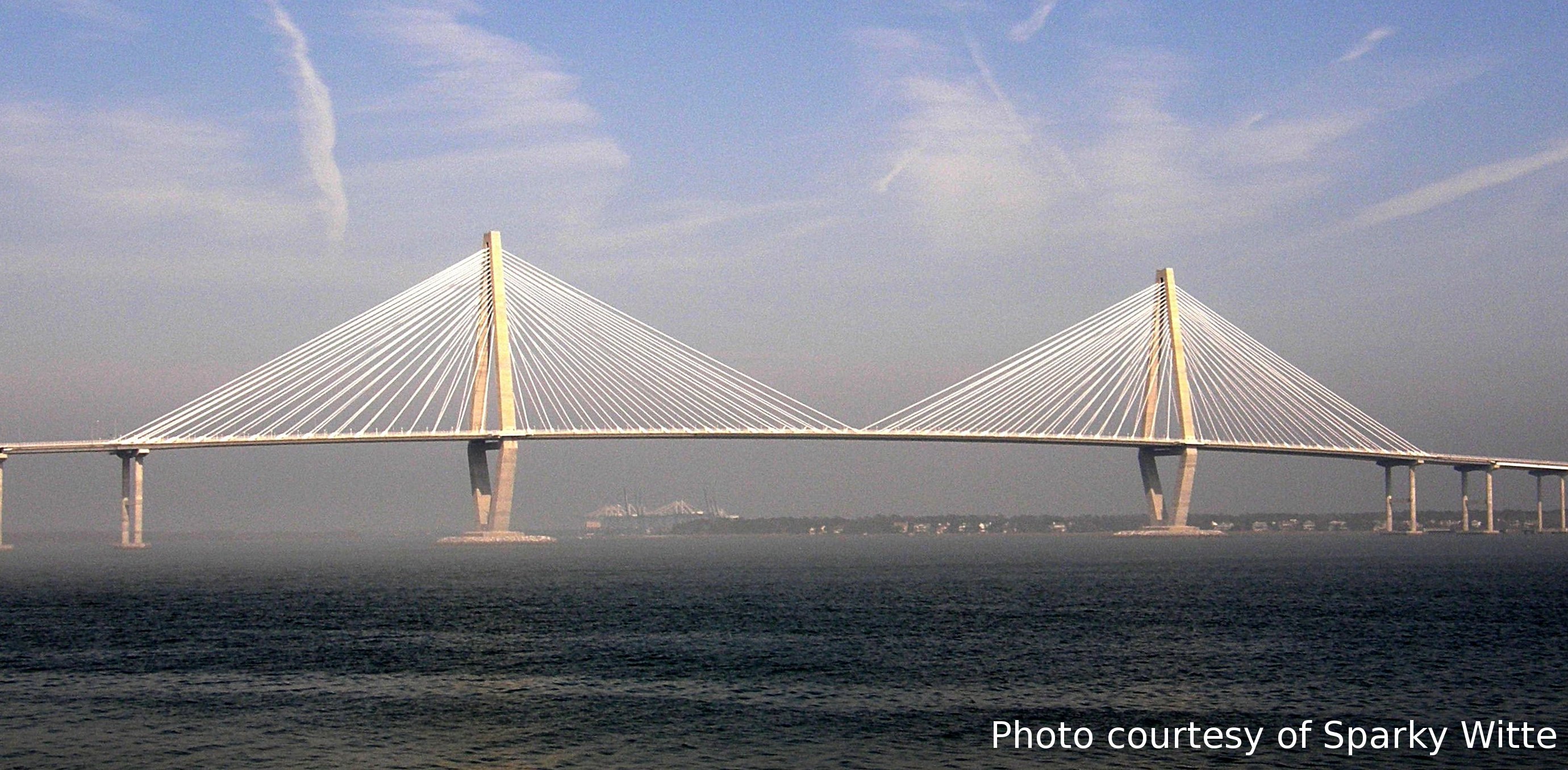
July 12, 2005: More views of a clean bridge
Sometimes the chemistry between folks with similar interests
is such that unexpected reactions (i.e. surprises) occur.
Today was on of those occasions. Wade Watson and PBC organized
an early morning helicopter ride around the bridge and arranged to
have all extraneous
stuff removed.
Needless to say - I had two cameras going - and from altitudes ranging
from 600 to 1200 ft - this is what I saw. We were doubly blessed since
the sun decided to say hello while we were flying. The early morning
sun created impressive views of the Arthur Ravenel Bridge while circling
between Mt. Pleasant to Charleston.
Looking south from the edge of Drum Island with a C-17 in the
upper right

Looking north over the Motley Rice Building

Looking toward Charleston from Mt Pleasant

Another look toward Charleston From Mt. Pleasant

Looking north toward the Naval Base


This work is licensed under a Creative Commons License.
Attribution: C. Frank Starmer from http://ravenelbridge.net
_